Stella(Xintian) Li

University of Pennsylvania
Dual degree candidate
Master of Urban Spatial Analytics
Master of Urban Planning
GIS analyst using spatial data analytics and data visualization to model spatial and temporal trends and identify spatial patterns. Urban enthusiast interested in solving urban problems with data-dirven methods, specifically around multimodal transporation planning.
LinkedIn Profile
Resume
Portfolio
Strong 2nd Place in Esri’s Intern Hackathon 2021:
TransitHero - Hacking the Way to Transit Equity
Responsibilities: I mainly worked on the hackathon idea and the predicted analytics section of the project. Successfully trained a machine learning model with multidimensional data and forecasted future bike demand in the DC area.
Predictive Modeling with R Programming
Predicting Bikeshare Trips in NYC
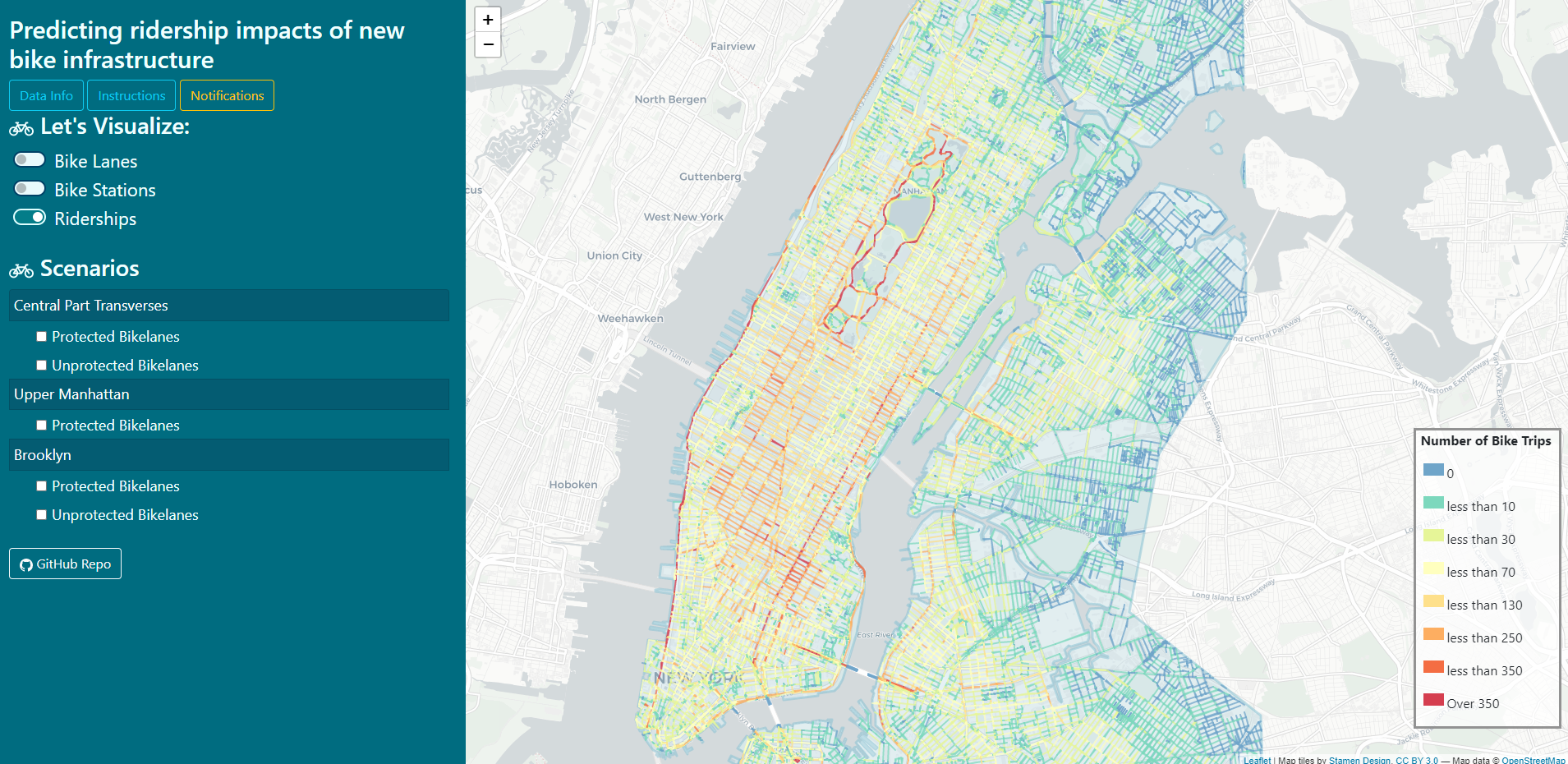
Responsibilities: Collaboratively worked in a team of 3. I focused more on the data cleaning part and model training & comparison part.
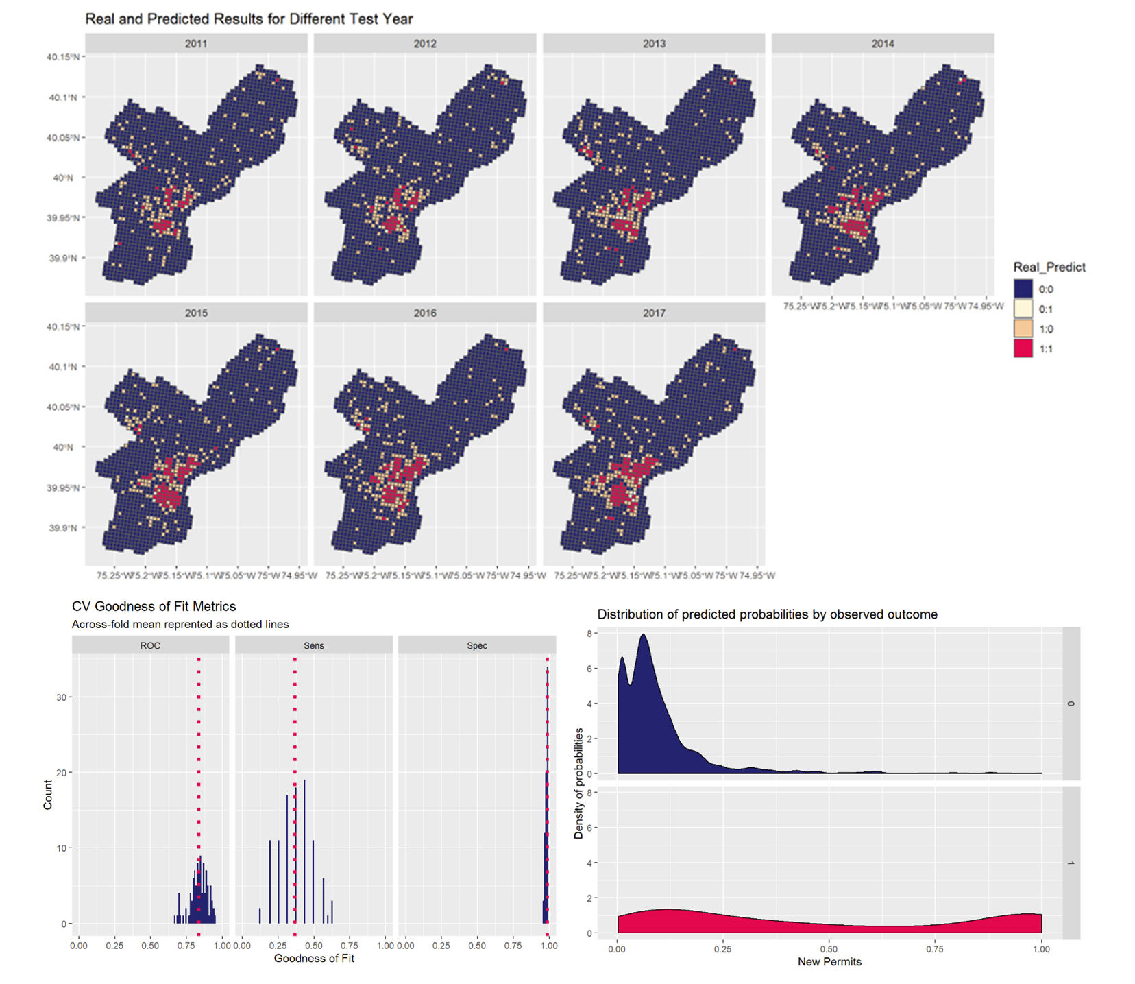
Forcast New Construction Permits in Philadelphia
Machine Learning and Deep Learning in Remote Sensing
Land Cover Classification and Identification
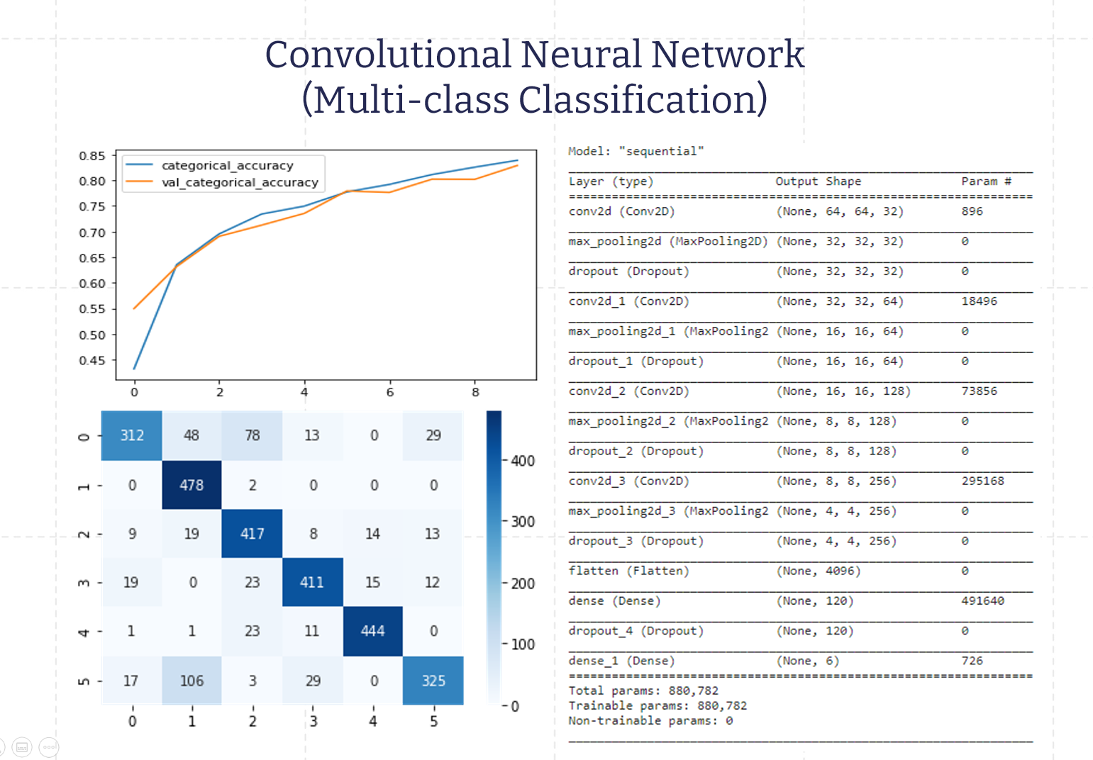
Responsibilities: Mainly responsible for the training and evaluation of SVM model, and the two CNN models.
Geospatial Analysis with ArcGIS
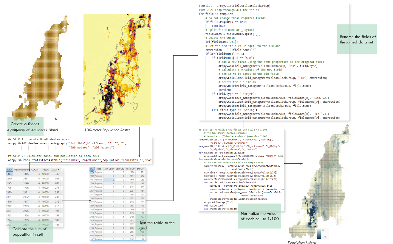
Social Vulnerability to Sea Level Rise on the Rhode Island
Data Wrangling and Data Visualization with Python and HTML
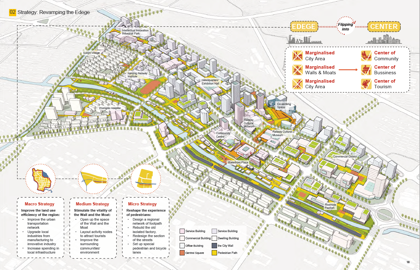
Selected Works in Transporation Planning, Urban Design and Urban Studies
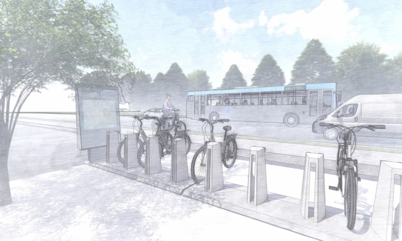
Urban Planning & Multimodal Planning
Sea Level Rise Studio
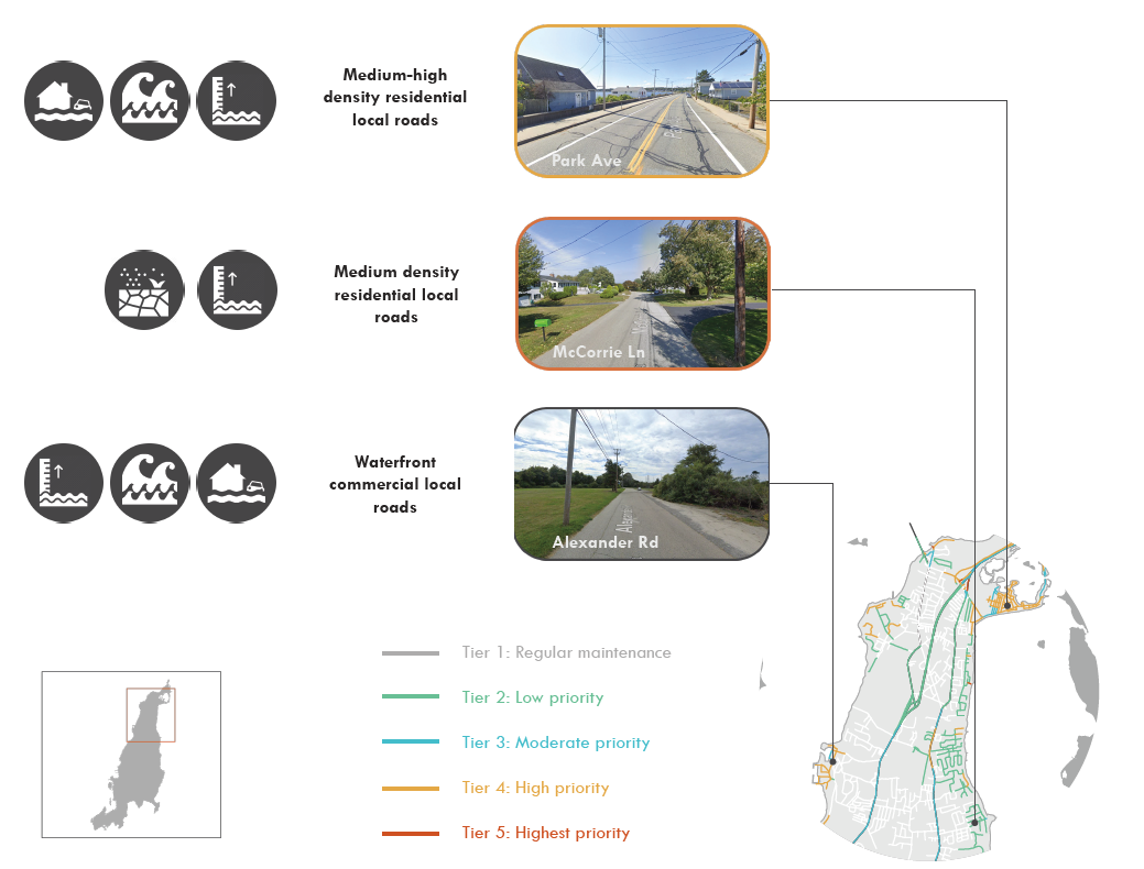 Responsibilities: Mainly Responsible for the Island-wide Road Infrastructure Protection in Face of Sea Level Rising here.
A Study on Commuting with Public Transit
![]()